


Environment Canada provided an update on the status of Hurricane Ernesto Friday afternoon and indicated it will have a relatively limited impact on the Atlantic provinces based on current projections.
The latest track of the storm has Ernesto’s centre passing well south of Nova Scotia and New Brunswick through Monday and Tuesday with a slight possibility it will make landfall on the southeastern tip of Newfoundland.
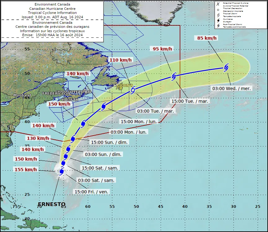 Environment Canada Meteorologist Bob Robichaud said that the main impacts for Nova Scotia and New Brunswick would likely be waves peaking at 10 metres overnight from Monday into Tuesday.
“At this time it looks like the centre of the storm will be far enough south that it won’t have a major impact on the maritime provinces,” said Robichaud.
Although that is what current projections are calling for Robichaud warned that it is possible the track could change over the weekend and encouraged residents across the maritime to check for updates on the storm over the weekend regularly.
By Tuesday morning, Ernesto is expected to be south of Newfoundland with a possibility that it could make landfall along the Avalon Peninsula. Ernesto is however likely to have decreased in intensity by that time and will likely no longer be categorized as a hurricane.
As of Friday afternoon, Ernesto was about 1,800 kilometres south of Halifax and travelling as a category two hurricane.

