




You can find the rocky summit of Mount Shubel about midway down the Digby Neck, a narrow strip of land that juts out into the Atlantic Ocean. In most places, the Neck’s width is under 3 kilometers wide, and together with Brier Island and Long Island, this narrow stretch of coastline forms the Northwestern shores of St. Mary’s Bay. Mount Shubel is hard to miss. Its vertical cliffs jut upwards to the right of the highway as you’re passing through Sandy Cove.
Finding the Trail
Make your way to Digby Neck and Island Scenic Drive, the main roadway that goes down the neck. Stay on this road for approximately 20 minutes, at which point you’ll be approaching Sandy Cove. The turnoff is just down the hill from the Digby Neck Fire Hall, which you’ll pass on your right. You’ll see a cottage just off the main road, also on the right, with a dirt road beside it heading for the mountain.
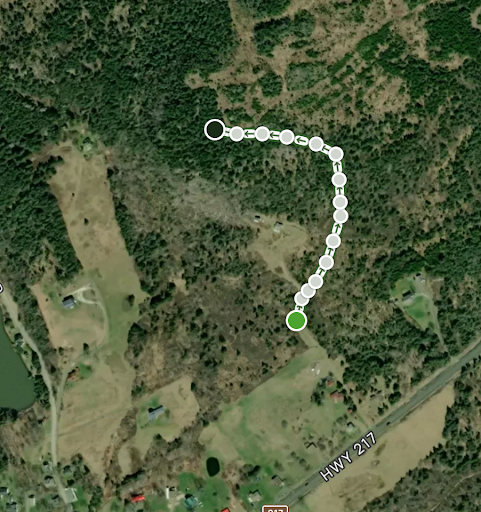
There are a few grassy areas along the road to park your car, and the trailhead will be on the righthand side. It’s important to note that the entire trail and mountain are on private property and the owners have kindly allowed hikers to use them, so please be courteous and respectful of the land.
The Hike
In the summer months, the early goings of the trail will be slightly overgrown with brambles but will eventually clear as you climb higher. As the trail widens, there will be ropes along the side to aid with the short, but steep, climb. The ascent is fast, certainly doable in under 30 minutes.
It won’t be long until you reach the first vantage point on the summit, a small clearing on the rockface to your left. If you follow the trail just a little further through the trees, you’ll emerge onto the bigger rock face, which offers a 180-degree view of the scenic Sandy Cove area.
The view is striking, with Sandy Cove and St. Mary’s Bay to your left, with the Acadian Shore far in the distance beyond. To your right, you have the Bay of Fundy, home of the world’s highest tides.